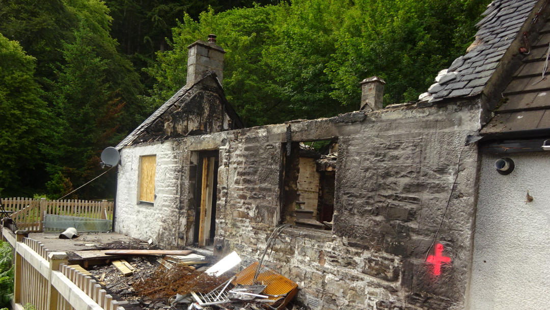
Insurance claim – Fire
- Location: Invermoriston, Highland
- Services Used:
- Aerial Inspection
- Aerial Mapping
- Building Defect Diagnosis
- Building Surveying
The problem and the solution
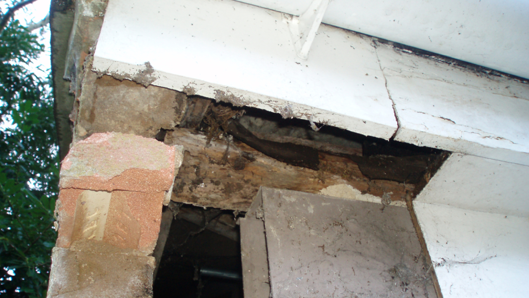
We were instructed by our client to provide support following a fire to a property causing extensive damage.
Our client required a detailed schedule of repair together management of the tender process to enable claim settlement to be negotiated.
Using a combination of traditional building surveying along with UAV data capture we were able to capture a detail dataset at initial visit.
Modelling the site into 3D and using cloud based technology allowed the project team to work collaboratively, remotely to refine the scope of work and negotiate settlement.
Positive Outcomes:
- 3D modelling of the site enabled collaborative working remote from site for the project team
- Detailed data capture allowed for accurate, fair claim settlement.


Latest projects